 |
|
The
Champion Submarine-Killing Submarine of World War Two |
|
|
|
|
Maps &
Driving Directions |
 |
|
|
|
|
Regional Directions to the USS BATFISH |
|
|
3055 Batfish Road
Muskogee, OK 74402 |
|
|
|
GPS Coordinates:
35
47.597 N, 95 18.625 W |
|
|
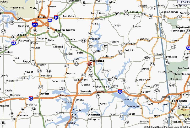
| From I-44, Exit 283, Near Vinita, Oklahoma:
Go south about 52 miles, passing through Pryor and Wagoner, until you
reach the Muskogee Turnpike. Go east on the Muskogee Turnpike about 7
miles to Exit 33 |
From I-44 in Tulsa, Oklahoma: Exit onto the southbound Broken Arrow Expressway (U.S. Highway 64) and follow it south through Broken Arrow where it merges with the Muskogee Turnpike. Follow the Muskogee Turnpike for about 33 miles to Exit 33. |
From I-40, South of Muskogee, Oklahoma: Take the Muskogee Turnpike north for about 24 miles until you reach Exit 33 (a sign marks the exit with "Port of Muskogee" and "War Memorial Park"). |
|
 |
|
|
|
|
|
|
|
Local Directions to the USS BATFISH |
|
|
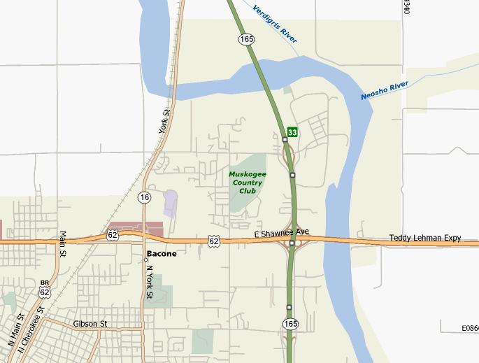
| Approaching Muskogee from the North: On the Muskogee Turnpike, look for Exit 33 (or "Port of Muskogee") just after crossing the Arkansas River. Take this exit and turn left (east) at the stop sign, crossing over the Muskogee Turnpike. Look for the
BATFISH sign on the left.
|
Approaching Muskogee from the South: On the Muskogee Turnpike, look for Exit 33 (or "Port of Muskogee", "War Memorial Park"). Take this exit and turn right (east) at the stop sign and look for the
BATFISH sign on the left.
|
|
 |
|
|
|
|
|
|
|
Detailed Directions to the USS BATFISH |
|
|
|
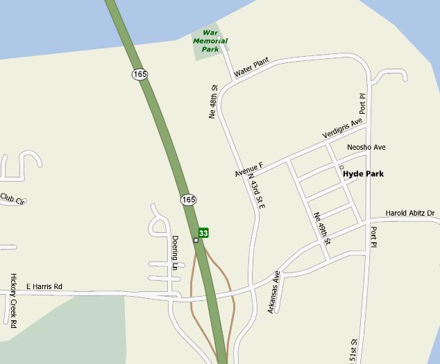
When you see the BATFISH sign , turn left (north). Follow this road for about 1/2 mile. You will pass over some railroad tracks and through a gate. When the road deadends, turn left into the WAR MEMORIAL PARK parking lot. Congratulations!! You have made it to the park and the USS BATFISH!!
|
|
 |
|
|
|
| |